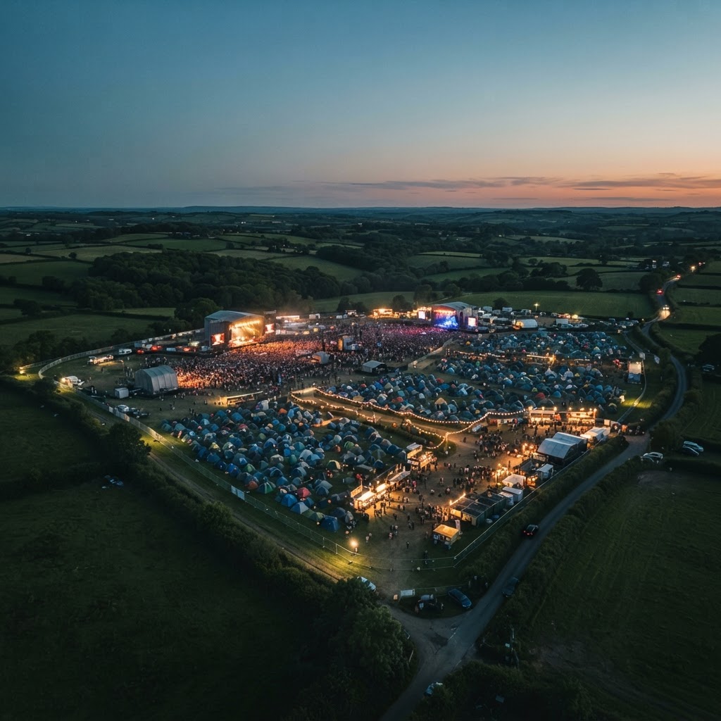
Festival & event aerial security
Your Festival.
Your Perimeter.
Our Eyes in the Sky.
Advanced drone perimeter security & real-time aerial intelligence
Protect your festival boundaries with professional aerial observation, high-definition video, thermal imaging and live intelligence delivered directly to your event management and security teams.
Airframe Drone Services provides specialist drone operations designed to improve perimeter awareness, identify potential security concerns and keep event control informed throughout your deployment.
- Professional UAV operations
- Day & night observation
- Live intelligence streaming
- Fully insured
- Site-specific flight planning
The perimeter challenge
Large Events. Extensive Boundaries. Constantly Changing Risks.
Festival boundaries can stretch for miles across fields, woodland, temporary infrastructure and access roads.
Maintaining awareness of activity across these areas is challenging, particularly after dark or during busy operational periods.
Ground security patrols and fixed CCTV provide essential coverage, but remote areas and changing conditions can make it difficult to maintain a complete operational picture.
Airframe adds an aerial perspective from outside the boundary. Our aircraft observe the perimeter and the land around it, look over the fence into the site, and feed what they see to your security team and organisers.
Where we focus
- The perimeter fence and the land around it
- Public and staff entrances and exits
- Public and staff car parks
- Storage, production and plant compounds
What we watch for
- Unauthorised access and break-ins
- Disorderly behaviour
- Fire and smoke
- Health and safety hazards
- Emergencies
Break-in at a storage compound
What could happen
Someone tampering with the fencing, gates or containers at an external compound holding equipment, bar stock or other high-value goods, often overnight when the site is quiet.
What aerial observation adds
From a flight position outside the compound, the crew can watch its fence line and access points, and use the thermal camera after dark to pick out people and vehicles nearby.
How it reaches event control
The crew reports what it can see and where to event control straight away, and authorised staff can view the live feed.
How your team uses it
Your team can send a response to the right gate with a clearer idea of how many people are involved and which way they went.
Illustrative example. Airframe’s aircraft, flight positions and ops base are all outside the festival boundary. We observe the fence line, entrances, car parks and external compounds, and look into the site from the boundary. We do not fly over the event or the crowd. Sectors are agreed with your security lead, and aerial observation is not continuous across the whole perimeter.
Aerial security capabilities
Aerial Intelligence Your Security Team Can Act On.
Six capabilities that work together as one operation, planned around your site and your security team.
 01
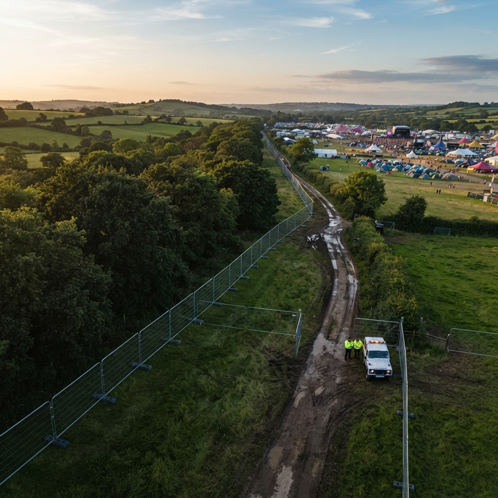
Aerial perimeter patrols
Observe the fence line and the land around it from flight positions outside the site.
Patrols follow the sectors and priorities agreed with your security lead. The aircraft looks along the fence and over it into the site, watching for break-ins, suspicious movement and emerging concerns along the boundary.
 Illustrative thermal view02
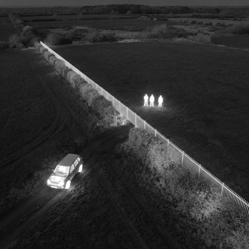
Thermal observation
Help identify people, vehicles and hot spots around the perimeter after dark.
Thermal imaging picks out temperature differences, so people, vehicles and the early signs of fire can stand out against cooler ground at night. It cannot see through solid objects and works best with a clear line of sight.
 03
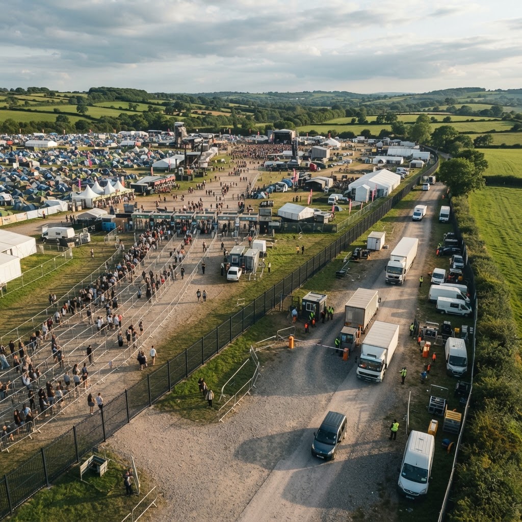
Priority-area monitoring
Entrances, car parks and compounds that need closer attention.
Public and staff entrances and exits, public and staff car parks, storage and production compounds and remote stretches of fence can be given priority, based on your site knowledge and previous years.
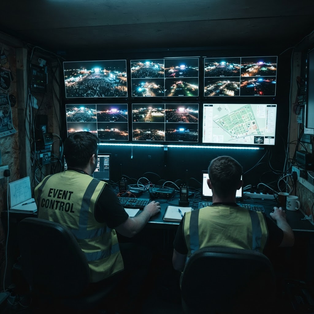 04
Live video & intelligence feeds
Live drone video streamed to the personnel you authorise.
A secure browser-based dashboard gives the people you authorise access to available live imagery, subject to connectivity on site.
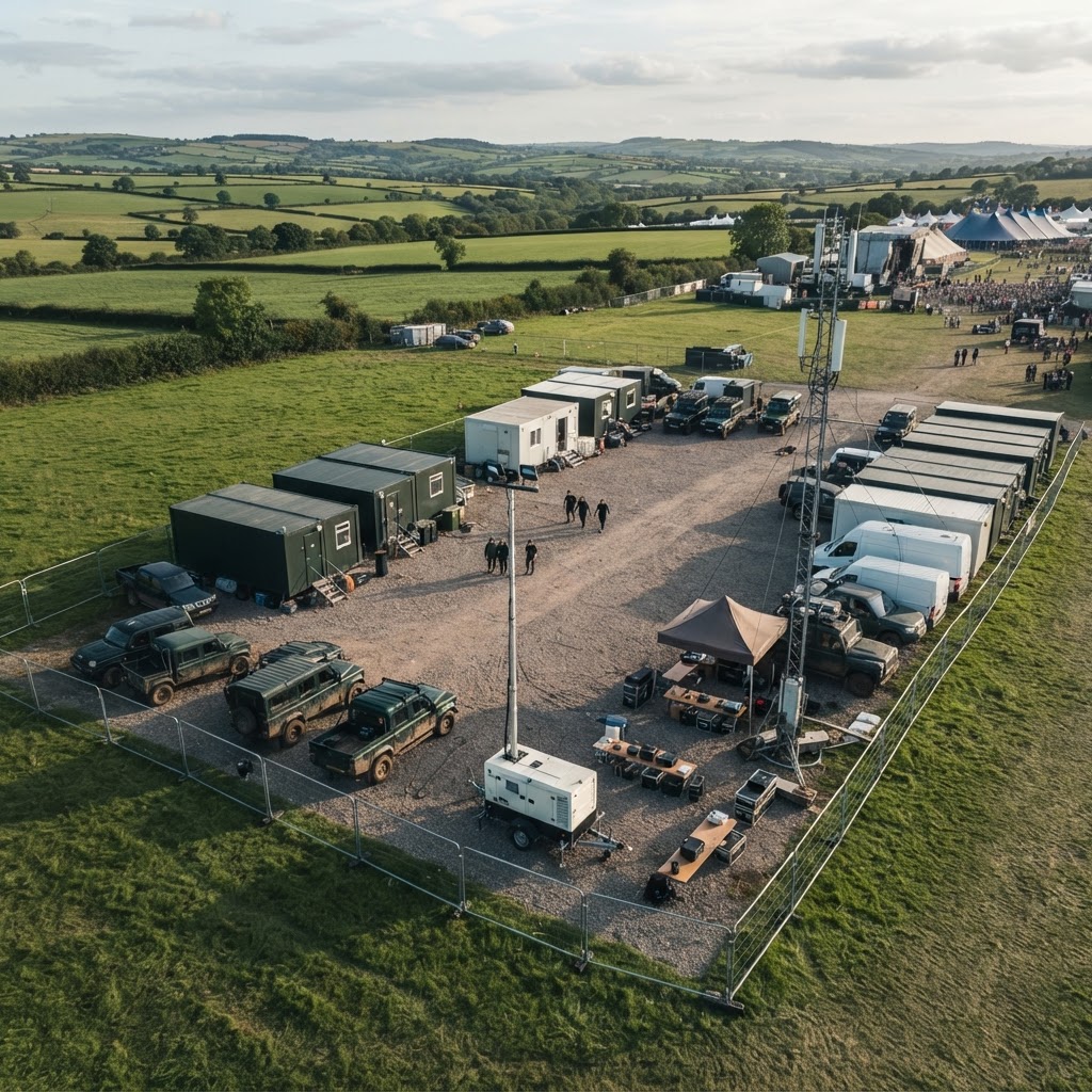 05
Direct security communications
Coordinate with your security team on agreed radio procedures.
Our crew works to the radio procedures and call signs you set, using your network or compatible equipment, so observations reach the right people in the right words.
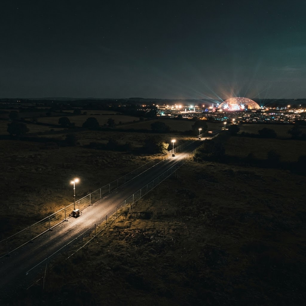 06
Incident recording & evidence collection
Capture relevant imagery for authorised review and reporting.
Relevant imagery and operational information can be retained for authorised review, incident reporting and potential evidential use, handled in line with data protection requirements.
Day & night intelligence
From Daylight to Darkness. A Clearer Operational Picture.
The same stretch of perimeter looks very different once the light goes. Visual and thermal imaging answer different questions, and together they keep the boundary in view across the whole event day.
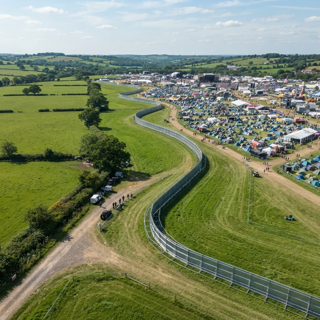
Daytime visual observation
Detailed colour imagery for watching agreed sectors, checking fence condition and documenting the site in daylight.
Night-time thermal observation
Thermal imaging shows warmer people and vehicles against cooler ground after dark, helping the crew notice movement near the boundary.
Thermal cameras detect surface temperature differences. They cannot see through walls, vehicles, dense foliage or other solid objects, and results depend on conditions. No system can guarantee that every person or event will be detected.
Our aircraft
Professional Aircraft. Specialist Aerial Capabilities.
Two enterprise aircraft, each with a clear job. Every deployment is planned around the aircraft, crew and sensors your site needs.
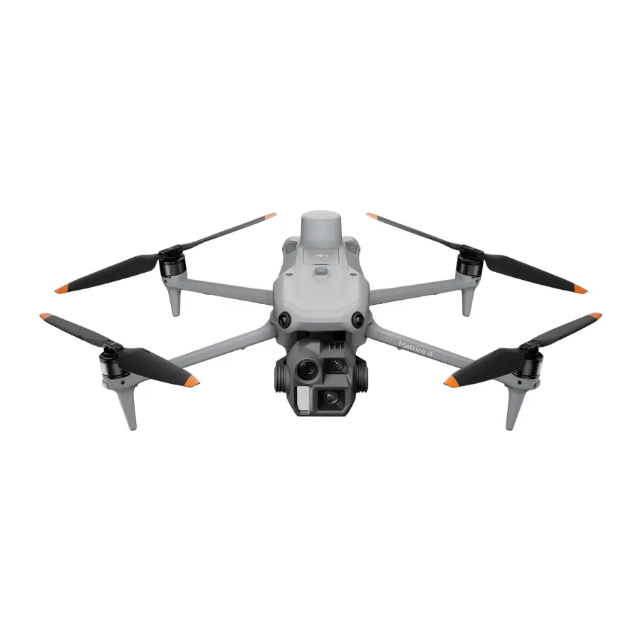
DJI Matrice 4E
Our daytime aircraft for visual perimeter observation, detailed site assessment and documenting the site before, during and after the event.
- High-resolution aerial imagery
- Visual perimeter observation
- Detailed site assessment
- Operational documentation
| Capability | Matrice 4E | Matrice 4T |
|---|---|---|
| Primary role | Daytime visual observation | Thermal and night-time observation |
| Visual camera | Yes | Yes |
| Thermal imaging | No | Yes |
| Night-time perimeter observation | Not our night platform | Primary use |
| Detailed site assessment | Primary use | Supporting |
| Live imagery to event control | Yes, subject to connectivity | Yes, subject to connectivity |
Live intelligence workflow
From the Aircraft to Your Event Control Team.
Airframe combines professional drone operations, its own operations base outside the event boundary, secure live streaming and direct communications to give event teams timely aerial information.
Drone camera
Collects available visual or thermal imagery from the agreed operational sectors.
Interactive scenario
See How Aerial Intelligence Supports a Security Response.
An illustrative night-time example of how an observation travels from the aircraft to your team on the ground.
Illustrative thermal viewStage 1 · Observe
During a planned night sortie, the aircraft observes movement near a remote perimeter sector on the thermal camera.
Illustrative scenario only. Times, locations and messages are examples, not a record of a real deployment.
Coverage options
Built Around Your Event. Focused Where It Matters.
Every deployment is tailored to the event’s operational requirements. These three approaches are a starting point for the conversation, not fixed packages.
Priority-sector coverage
Observation focused on selected stretches of fence, public and staff entrances, car parks, storage compounds and recurring problem areas.
Multi-sector perimeter operations
Planned observation across multiple agreed perimeter locations, working through the boundary to a plan agreed with your security lead.
Extended event coverage
Planned aerial operations across selected event periods, with additional crews and aircraft where operationally appropriate.
Cover across the event lifecycle · select a phase
Planned day and night sorties over the agreed sectors, with live imagery and radio contact with event control.
Aerial observation is planned in sorties over agreed sectors and periods. It is not continuous airborne surveillance of the whole site. Simultaneous operations need appropriate aircraft, crews, planning and authorisations, and are scoped with you before the event.
Compliance & operations
Professional Flight Operations. Planned Around Your Event.
Airframe manages the aviation planning and operational requirements associated with its deployment, so your team can concentrate on running the event. As a CAA Registered Drone Operator, we plan every operation to the rules that apply to it.
Before the event
- Site-specific flight planning
- Airspace assessment
- Applicable permissions and authorisations
- Flight positions outside the site, away from uninvolved people
- Risk assessment
- Method statement
- Insurance documentation
- Communications planning
During the event
- Pilot and spotter deployment
- Operational coordination with event control
- Flight logging
After the event
- Incident reporting
- Agreed handover of recorded imagery
Why Airframe
More Than a Drone in the Sky.
Airframe Drone Services provides a coordinated aerial intelligence capability, combining specialist aircraft, professional flight crews, live communications and operational planning.
Our role is to give your existing event management and security teams a clearer aerial perspective and timely information to support informed decisions.
Specialist drone operations
Professional aircraft flown by trained pilots with spotters, from positions outside your site.
Day and thermal observation
Visual and thermal aircraft so the boundary is not forgotten once the light goes.
Live video delivery
Available aerial imagery on a secure dashboard for the people you authorise.
Direct security liaison
Observations passed to your team on your radio procedures, as they happen.
Incident imagery and reporting
Relevant footage retained and logged for authorised review after an incident.
Professional operational planning
Flight planning, risk assessments and method statements handled by us.
Flexible deployment options
Cover shaped around your priority areas, event phases and site.
Nationwide service availability
Based in Hampshire and deploying to events across the UK.
FAQ
Frequently Asked Questions
If your question is not answered here, add it to the enquiry form and we will come back to you on it.
Festival drone security gives your security team an aerial view of the perimeter and the land around it, including the fence line, public and staff entrances, car parks and storage compounds. It is particularly useful on long or remote stretches that are slow to patrol on foot and hard to cover with fixed CCTV. Our crew passes relevant observations to event control and authorised staff can view available live imagery, so your team can decide where to send people with better information. It supports your existing security operation rather than replacing it.
No. Our aircraft, flight positions and operations base are all outside the festival boundary, and we do not fly over the event or over people who are not involved in our operation. From outside, the cameras look along the fence line and over it into the site, and zoom gives useful detail without flying overhead.
Anything that affects the security and safety of the perimeter and the land around it: unauthorised access and break-ins, disorderly behaviour at entrances and in car parks, fire and smoke, health and safety hazards such as damaged fencing or blocked emergency routes, and emergencies. What we see is passed straight to your security team and event organisers.
Yes. Night-time observation uses the DJI Matrice 4T, which carries a thermal camera that shows heat signatures against cooler surroundings. Night flights are planned and risk-assessed for each site and remain subject to the permissions and conditions that apply. Thermal imaging cannot see through solid objects, and no system can guarantee that every person or event will be detected.
Yes. Available live imagery can be streamed to a secure browser-based dashboard for the personnel you authorise. Streaming depends on connectivity at the site, which we look at during planning.
Yes. We agree radio procedures, call signs and reporting points with your security lead before the event. Our crew then relays relevant observations to event control or designated security personnel using your radio network or compatible equipment.
No. Airframe provides aerial observation, imagery and information. Your security team remains responsible for assessing incidents and for any physical response. The service is designed to give that team a clearer picture, not to take on its role.
Yes. Most deployments are built around priority sectors, such as known problem areas, remote stretches of fence, public and staff entrances, car parks, storage compounds and service routes. We agree these with you during planning and can adjust the focus during the event if your priorities change.
Simultaneous operations can be planned where they are operationally appropriate. They need additional aircraft and crews, careful planning and the relevant authorisations, so we scope them with you at the planning stage.
Flights depend on weather and safe operating conditions, and the decision to fly rests with the pilot in command. We agree with you in advance how weather-affected periods will be communicated and handled, and keep event control informed during the event so your team can plan around any pause in aerial cover.
It depends on the site, the surrounding airspace, the time of day and how close operations are to people. We carry out the airspace assessment for each event and arrange the permissions and authorisations our operation needs. We will also need the landowner’s and event organiser’s agreement to the take-off and landing positions we use.
Yes. Relevant recordings and imagery can be handed over after the event in an agreed format for authorised use, such as incident review or reporting. Footage is handled in line with data protection requirements.
As early in your planning as possible. Airspace and permission requirements vary from site to site, and early contact gives us time to assess the site, plan sectors with your security lead and arrange what the operation needs.
Yes. We are based in Basingstoke, Hampshire, and deploy to events across the UK. Travel for the crew is set out in the proposal so the full cost is clear from the start.
Start the conversation
Let’s Strengthen Your Event Perimeter Awareness.
Tell us about your festival or event, your perimeter and the areas where additional aerial intelligence could make a difference.
Our team will review your requirements and discuss a suitable operational approach.
- We review your event, site and priorities, and check the airspace.
- We talk through sectors, timings and how we would work with your security lead.
- You receive a proposal with the operational approach and costs.