
Infrastructure
& Asset
Inspection Imagery
Replace scaffolding. Capture better data.
Smarter
Capture.
Better
Evidence.
WHAT WE DO
Airframe's Inspection Capture service gives organisations the high-resolution visual and thermal imagery their teams need to assess critical assets safely, efficiently, and cost-effectively.
From commercial buildings and infrastructure to energy assets and critical facilities, our drone-based approach delivers faster deployment, safer operations, and significantly more detailed imagery than traditional access methods.
We remove the need for scaffolding, mobile elevated work platforms, and working at height — replacing them with rapid aerial deployment, high-resolution visual data, and organised image sets your own team can work from directly.
DEPLOYMENT
Hours, Not Days
DELIVERY
Indexed & Organised
OPERATIONS
CAA Qualified & Insured
From roof and building imagery to infrastructure surveys and long-term monitoring programmes — see how drone-based capture replaces scaffolding with smarter, safer, faster data collection.
SEE OUR SERVICES
Services We Offer
Roof & Building Capture
Fast, safe aerial photography and video of roofs, facades, gutters, chimneys, cladding, and building envelopes — without scaffolding or working at height.
Suitable for facilities managers, property managers, roofing contractors, and building owners.
Infrastructure Capture
Drone-based imagery of bridges, towers, structures, and critical infrastructure without the risks and costs associated with working at height.
Suitable for local authorities, civil engineers, highways agencies, and infrastructure asset owners.
Solar PV Capture
Visual and radiometric thermal imagery of solar installations, covering panel surfaces, thermal anomalies, soiling, and array coverage across ground-mount and rooftop systems.
Suitable for solar farm operators, energy contractors, facilities managers, and agricultural solar installations.
Asset Condition Capture
Detailed condition imagery for commercial, industrial, and public-sector assets. Organised, indexed image sets your surveyors can use to support maintenance planning and capital investment decisions.
Suitable for facilities managers, asset managers, local authorities, and commercial property owners.
Utilities & Telecoms Capture
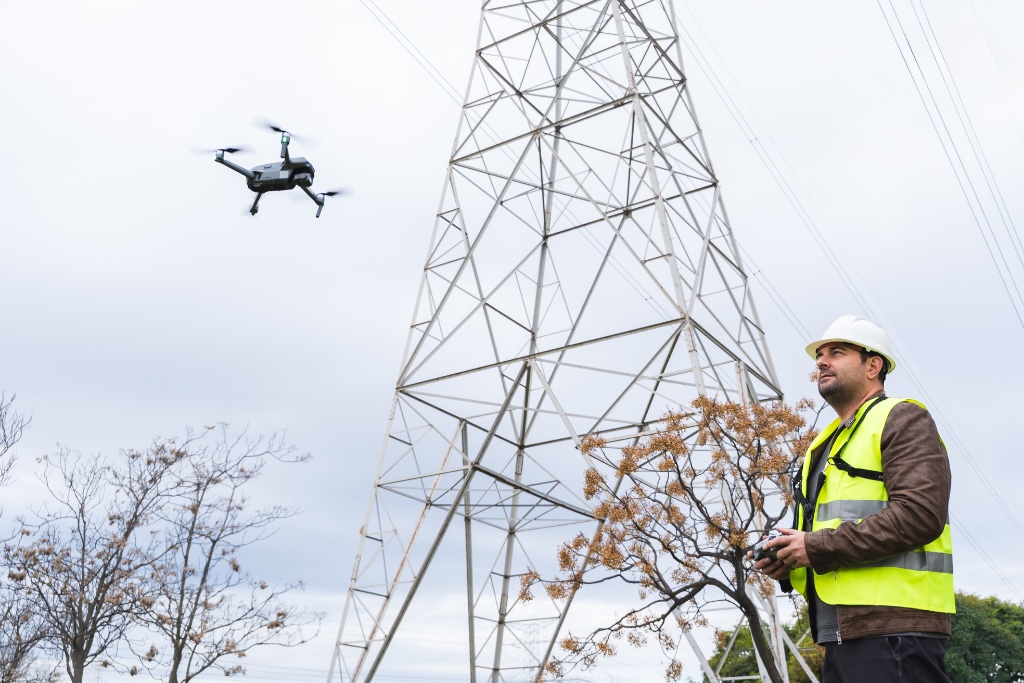
Aerial imagery of utility infrastructure, telecommunications masts and equipment, overhead lines, substations, and associated assets — reducing access risk and survey time significantly.
Suitable for utility operators, telecoms companies, network infrastructure managers, and energy distribution teams.
Construction Progress Monitoring
Regular aerial capture to support project oversight, stakeholder communication, and programme management. Provides a timestamped visual record of site progress from groundworks to completion.
Suitable for main contractors, project managers, developers, and quantity surveyors.
Asset Monitoring Programmes
Scheduled capture and long-term monitoring programmes that record asset condition over time. Establish a visual baseline, build a comparable image history, and support proactive maintenance decisions.
Suitable for estates teams, facilities managers, infrastructure operators, and portfolio property owners.
Environmental & Land Monitoring
Aerial capture of land, watercourses, vegetation, and rural or agricultural environments. Supporting land management, planning compliance, ecological surveys, and environmental reporting.
Suitable for land managers, environmental consultants, planning authorities, and agricultural operators.
Thermal Imaging Surveys
Radiometric thermal capture for buildings, solar PV, electrical infrastructure, and more. Our thermal imaging service has its own dedicated page with full details of capabilities, equipment, and deliverables.
View Thermal Imaging ServicesWhat You'll Receive
Every survey is delivered as an organised, indexed image set, not an unsorted folder of files. Imagery is labelled by elevation, location, and reference point — ready for use by contractors, engineers, asset managers, and insurers.
High-Resolution Inspection Imagery
Detailed aerial imagery of asset surfaces, elevations, and hard-to-reach areas — captured at the resolution your team needs for professional assessment.
Indexed Image Sets
Clear, structured image sets organised by elevation, location, and reference point — ready to share with contractors, boards, or insurers.
Reference Annotation
Locational labelling and referencing of captured imagery to support your own assessment, lifecycle planning, and operational risk management.
Asset Monitoring Records
Historical capture data and comparable image records for long-term monitoring programmes — building a visual baseline over time.
Georeferenced Data
Captured imagery tied to accurate location data so your team can locate any area immediately without additional site visits.
Digital Delivery
All imagery and data securely delivered in accessible digital formats. Compatible with asset management systems and document platforms.
All deliverables are formatted to feed directly into your own maintenance planning, insurance submissions, contractor briefings, and compliance documentation.
OUR SCOPE
Capture, Not
Interpretation
Airframe is a specialist data capture operator. We fly the asset, capture the imagery, and deliver it indexed and referenced. We do not produce condition reports, defect assessments, or professional recommendations.
That boundary is deliberate. Condition judgement sits with your surveyor, engineer, or thermographer, where the professional accountability belongs. We give them better evidence to work from, faster and more safely than any access method they could arrange themselves.
The result is a service that fits alongside your existing professional team rather than competing with it — and a cost base that reflects capture work, not consultancy.
How It Works
01. Brief
We discuss your assets, objectives, capture requirements, access arrangements, and delivery needs. No obligation — just a clear conversation about what you need and how we can help.
02. Plan
Our team prepares detailed flight plans, risk assessments, CAA permissions where required, and full site logistics. We handle all pre-flight compliance so you do not need to.
03. Capture
Using the DJI Matrice 4T and specialist sensors, we capture detailed visual and thermal survey data at the resolution and coverage your asset requires.
04. Deliver
Captured imagery and data are indexed, referenced, and organised into a structured set, then delivered digitally — typically within 48–72 hours of the survey.
PARTNERSHIP VALUE
Why Choose
Airframe?
Safer Access
Reduce risk by eliminating unnecessary working at height and difficult access requirements. Our aerial approach removes the need for scaffolding, MEWPs, and manual access in dangerous environments.
Faster Deployment
Capture comprehensive survey data in hours rather than days. We mobilise quickly, minimise site disruption, and deliver results on timescales that support your operational needs.
Better Data
High-resolution visual and thermal imagery provides greater detail than most traditional access methods — giving your surveyors a clearer picture of asset condition with less margin for error.
Organised Delivery
Every survey produces an indexed image set with clear referencing, consistent coverage, and labelled locations — not an unsorted folder of files your team has to sift through.
CAA Qualified & Insured
All our operators are CAA certified and fully insured with comprehensive public liability cover, so every inspection is carried out safely, legally, and professionally.
LET'S BUILD YOUR PROJECT
Ready To Capture
Smarter?
From commercial buildings and infrastructure to energy assets and critical facilities, Airframe captures the aerial imagery your team needs to inspect, monitor, and manage assets with confidence.
Tell us about your project and we will come back to you with a clear approach and a straightforward price.
GET STARTED TODAY
Ready To Capture Smarter?
Talk to our team about your asset capture requirements. We will confirm availability, approach, and costs upfront — no obligation.