Every Stage.Every Flight.Documented.
Professional aerial monitoring and survey grade mapping for construction projects across the United Kingdom. From initial groundworks through to practical completion.
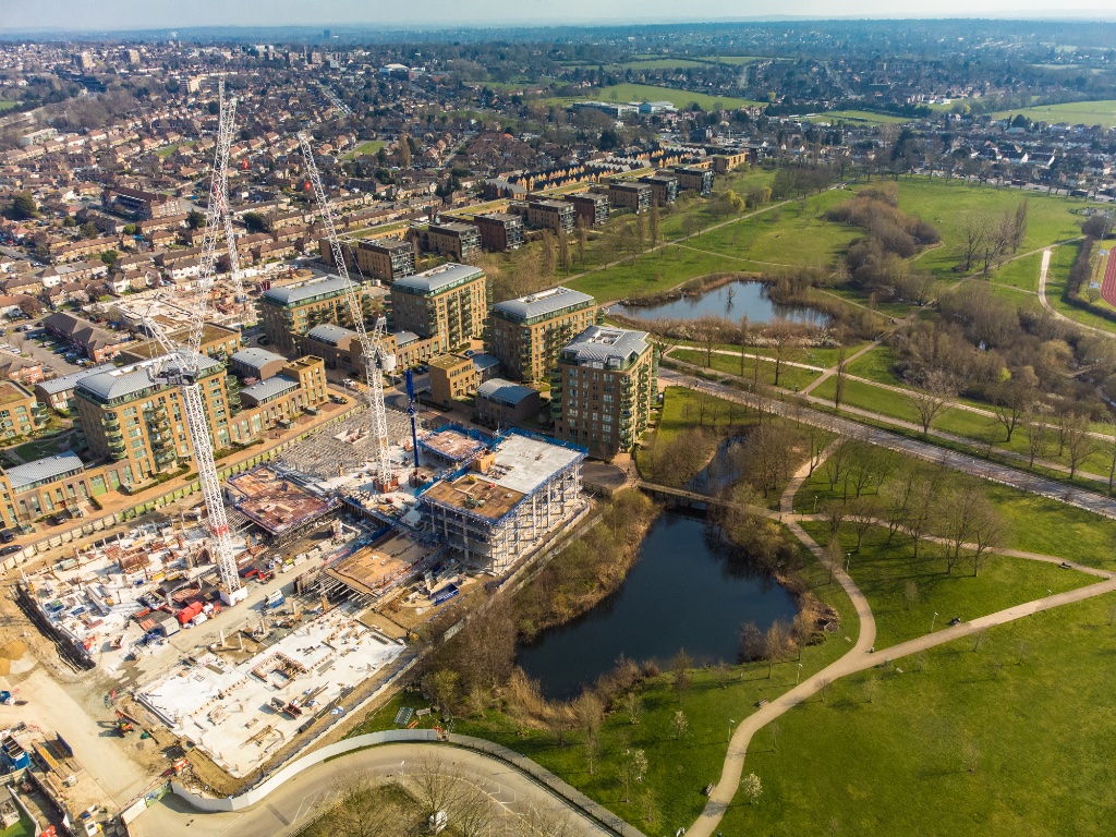
Construction sites are fast moving, complex, and difficult to document accurately from ground level. The bigger the project, the harder it becomes to maintain a clear picture of progress, protect your project record, and keep stakeholders informed with reliable visual evidence.
Airframe puts a CAA qualified drone pilot above your site on a regular, scheduled basis. We capture the aerial imagery, survey data, and project intelligence your team needs to track progress, report with confidence, and build a complete visual record from the first groundworks through to handover.
We work directly with main contractors, developers, project directors, consultants, housing associations, and public sector clients on projects of all scales across the United Kingdom. Whether you need a straightforward monthly progress visit or a full photogrammetry and mapping programme running alongside your build, we build a monitoring schedule around your project.
Find out how we workSEE OUR SERVICES
What We Do
Construction Progress Monitoring
Scheduled aerial site visits capturing high resolution photography and video throughout the full project lifecycle. Tailored to your reporting cycle from weekly progress visits to monthly milestone captures.
Project Documentation
Comprehensive aerial records building a permanent visual history of your project from groundworks through to practical completion. Structured, dated, and available for audit or reference throughout the programme.
Stakeholder Reporting Assets
Professional imagery and video content produced for client reports, investor updates, board presentations, planning submissions, and contractor portfolios.
Orthomosaic Mapping
Survey grade 2D orthomosaic maps generated from high resolution aerial imagery. Accurate, geo referenced outputs suitable for planning, site analysis, and progress comparison over time.
SURVEY GRADE3D Modelling and Digital Surveys
Photogrammetry derived 3D models and digital terrain visualisations providing detailed spatial data on site conditions, structural progress, and volumetric measurements at any construction stage.
SURVEY GRADETimelapse Monitoring Programmes
Scheduled drone deployments across the full project duration creating a compelling timelapse record of site progression for documentation, handover communications, and marketing.
Practical Completion and Handover Content
Professional aerial photography and video produced at practical completion and ready for client handover packs, contractor portfolios, planning authority submissions, and development marketing.
Site Surveys and Overviews
High level aerial site intelligence providing a clear overview of site conditions, contractor activity, access routes, boundary confirmation, and project context before and during construction.
SURVEY GRADE CAPABILITY
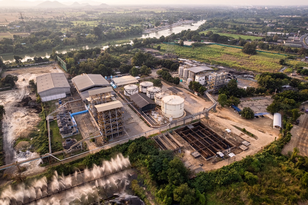
Aerial Mapping and Photogrammetry
Precise aerial data for planning, site analysis, and project decision making.
Alongside our visual monitoring services, Airframe provides professional aerial mapping and photogrammetry for construction and development projects where accurate spatial data is a programme requirement.
Using pre programmed waypoint flight missions, our pilots capture systematic, repeatable aerial datasets across your site. This data is processed through professional photogrammetry workflows to produce accurate 2D and 3D outputs that support planning, earthworks management, volumetric calculations, and site analysis throughout the construction programme.
MAPPING OUTPUTS
Mapping and Survey Deliverables
All mapping missions are conducted by Certified and Insured pilots, with full risk assessment and site specific flight planning completed prior to each deployment. Outputs are supplied in GIS compatible formats and can be integrated into your existing project data environment.
All mapping outputs are supplied in professional formats compatible with your project software and reporting requirements.
DELIVERABLES
What You Will Receive
Progress Photography
Dated, high resolution aerial imagery documenting site activity, construction progress, and project milestones. Delivered in organised digital formats after each site visit.
Aerial Progress Videos
Professionally processed aerial video content showcasing project development, key construction stages, and site progress. Ready for stakeholder updates, internal reporting, and social media.
Stakeholder Reporting Assets
Visual content produced for project reports, client updates, investor communications, board presentations, and planning submissions. Formatted for immediate use with no additional preparation.
Site Documentation Records
A comprehensive aerial archive building a complete visual history of your project development. Structured, date stamped, and available throughout and beyond the construction programme.
Mapping and Survey Outputs
Orthomosaic maps, 3D terrain models, elevation data, and volumetric analysis outputs produced from photogrammetry workflows and supplied in formats compatible with your project requirements.
Secure Digital Delivery
All imagery, video content, mapping outputs, and project assets delivered securely via organised digital transfer with clear file naming, version control, and structured folder organisation.
How It Works
Brief
We discuss your project requirements, reporting schedule, monitoring frequency, and deliverable formats. No obligation. We will tell you exactly what is practical for your site before any commitment.
Plan
Our team prepares site specific flight plans, risk assessments, and all pre mission logistics to ensure full CAA compliance. Your site does not need to stop or change anything for us. Every detail is handled.
Capture
Regular drone deployments capture aerial imagery, video, and photogrammetry datasets across your site. All missions are conducted by CAA qualified pilots operating to professional standards. Consistent and reliable.
Deliver
All content is professionally processed and delivered securely in formats ready for immediate use by your project team. Turnaround from site visit to delivery is fast. You are never left waiting long for data.
PARTNERSHIP VALUE
Why Choose
Airframe
Complete Project Visibility
Maintain a full visual record of your project from the first groundworks through to practical completion. Every visit is documented, dated, and archived for the life of the programme. No gaps. No missing milestones.
Stronger Stakeholder Communication
Give clients, investors, and project teams clear, professional visual evidence of progress. Aerial imagery and video content land considerably better in board reports and investor updates than ground level photographs.
Safer Site Intelligence
Gather comprehensive site information from above without disrupting ongoing works or creating additional health and safety considerations at ground level. The site keeps running. We work around it.
Professional Output, Fast Turnaround
Receive processed, ready to use imagery, video, and mapping data quickly after each deployment. Content is delivered in organised formats with no additional editing or preparation required from your team.
UK Nationwide Coverage
We support construction projects across the United Kingdom. Flexible monitoring programmes and rapid deployment mean we can be on site when your programme requires it, not when it is convenient for us.
Built for the
Construction Industry
We work exclusively in the commercial sector. Every Airframe client is a business or organisation that needs reliable, professional aerial services delivered to a professional standard with the appropriate credentials, insurance, and risk management documentation in place.
If you are responsible for a construction project and need aerial monitoring, mapping, or documentation services, we understand your programme, your reporting requirements, and the level of professionalism your stakeholders expect.
COMMON QUESTIONS
Frequently Asked Questions
LET'S TALK ABOUT YOUR PROJECT
Ready to Monitor
Your Project?
From residential developments and commercial builds to civil engineering and public sector construction, Airframe provides reliable aerial monitoring and mapping that gives your project team the visibility it needs from day one.
Tell us about your project and we will come back to you with a programme proposal. No obligation. No pressure. Just a straightforward conversation about what works for your site.