THERMAL IMAGING
See What the
Eye Can’t
Thermal drone capture that finds hidden problems before they become expensive ones — delivered as organised, radiometric imagery your thermographer can work from directly.
CAA qualified. Fully insured. Operating across the UK.
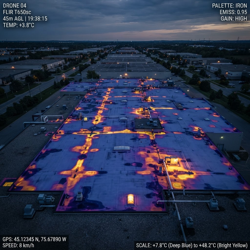
Thermal imaging gives you a layer of information that standard cameras simply cannot provide. By detecting temperature differences across surfaces and structures, our DJI Matrice 4T captures anomalies invisible to the naked eye — moisture trapped beneath a roof membrane, a failing solar cell in a 500 panel array, an overheating junction box on a live substation.
We deploy across the UK for commercial, industrial, infrastructure, and agricultural clients. Every survey is carried out by a CAA qualified pilot and delivered as organised, indexed thermal imagery you can share directly with your thermographer, contractors, insurers, or asset managers.
WHAT WE SURVEY
What We Survey
Roofing & Building Envelope
Thermal drone surveys are one of the most efficient ways to assess large or complex roof structures without scaffolding, MEWP hire, or putting personnel at height.
- Trapped moisture and water ingress
- Insulation failure and cold bridging
- Air leakage paths
- Membrane damage and delamination
- Structural heat anomalies
Suitable for flat roofs, industrial units, warehouses, schools, commercial property portfolios, and housing developments.
Solar PV Inspections
A single underperforming string can silently reduce the output of an entire array. Thermal imaging identifies faults at cell level, quickly and without downtime.
- Hot spots and failing cells
- Bypass diode faults
- String and module underperformance
- Soiling patterns and delamination
- Wiring and connection anomalies
Suitable for ground mount farms, rooftop commercial arrays, and agricultural solar installations.
Infrastructure & Electrical
Overheating components rarely fail silently — they give thermal warning signs well in advance. We identify them before they become safety incidents or unplanned outages.
- Overloaded or failing transformers
- Faulty switchgear and junction boxes
- Overheating cables and conduit runs
- Thermal anomalies in pipework and mechanical plant
- HVAC performance issues
Suitable for utilities, industrial facilities, data centres, manufacturing, and facilities management teams.
Construction & Asset Monitoring
Thermal drone surveys integrate naturally into construction programmes and ongoing asset management, giving you a repeatable, documented record of structural performance over time.
- Pre handover building envelope surveys
- Defect identification and snagging support
- Long term condition monitoring
- Insurance and compliance documentation
- Asset register photography alongside thermal data
Suitable for main contractors, M&E contractors, facilities managers, and property owners.
Agricultural & Land Monitoring
Thermal imaging provides powerful visibility across large rural landholdings, particularly after dark or across terrain that is impractical to cover on foot or by vehicle.
- Livestock health and location monitoring
- Perimeter and boundary sweeps
- Wildlife activity tracking and management
- Watercourse and drainage monitoring
- After hours observation across large landholdings
Suitable for farm operators, estate managers, agricultural contractors, and rural landowners.
Owner authorised aerial observation only. No enforcement or law enforcement services provided.
Search & Rescue Support
Thermal imaging dramatically increases detection capability in low light, difficult terrain, or time critical search scenarios. The Matrice 4T’s radiometric sensor detects body heat against background temperature at range, even in near zero visibility conditions.
- Missing persons searches
- Night operations and low light deployments
- Difficult or inaccessible terrain coverage
- Large area sweeps with AI assisted target detection
- Incident response coordination support
Suitable for search and rescue organisations, incident response teams, land managers, and event safety teams.
WHAT YOU RECEIVE
What You Receive
Every thermal survey is delivered as an organised, indexed image set, not a folder of raw files. Imagery is temperature referenced and georeferenced so your thermographer knows exactly where to focus.
Thermal & RGB Imagery
Side by side visual comparisons for every anomaly — thermal imagery shown against standard photography for immediate context.
Radiometric Data Files
Pixel level temperature values in RJPEG format for technical analysis, asset management integration, or audit documentation.
Annotated Imagery
Marked up thermal images with temperature readings and fault references — ready to hand to your thermographer or submit to an insurer.
Location Mapping
Imagery georeferenced to a site map so your team can locate problem areas immediately without additional site visits.
Indexed Thermal Reference
Organised, referenced image set grouped by asset area and temperature reading — so your thermographer can navigate the capture and draw their own conclusions.
Optional Video Walkthrough
Narrated walkthrough of the captured imagery available on request — useful for remote stakeholders or client handover meetings.
Deliverables are formatted to feed directly into your own thermographer's analysis, maintenance planning, insurance submissions, and compliance documentation.
OUR SCOPE
Capture, Not
Certification
Airframe is a specialist thermal capture operator. We fly the asset, capture radiometric imagery, and deliver it indexed and temperature referenced. We do not produce certified thermography condition reports, defect diagnoses, or professional recommendations.
That boundary is deliberate. Certified thermographic analysis and condition judgement sit with your Level 2 (or Level 3) thermographer, where the professional accountability belongs. We give them better radiometric data to work from, faster and more safely than any access method they could arrange themselves.
The result is a service that fits alongside your existing thermographer or surveyor rather than competing with it — and a cost base that reflects capture work, not consultancy.
THE PLATFORM
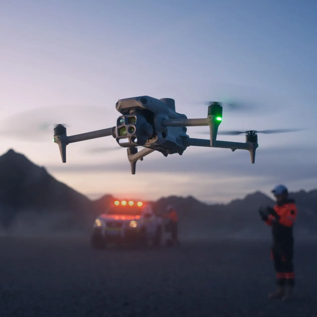
Flown on the DJI Matrice 4T
We operate the DJI Matrice 4T — a purpose built enterprise thermal platform combining a 640x512 radiometric thermal sensor, a 48MP visual camera, and a laser rangefinder in a single aircraft. It delivers accurate temperature data, precise georeferencing, and AI assisted fault detection in a single flight.
For clients, that means faster surveys, more accurate data, and imagery you can stand behind — whether that’s supporting your thermographer’s findings, briefing a roofing contractor, or submitting documentation to an insurer.
THERMAL SENSOR
640x512 Radiometric
VISUAL CAMERA
48MP RGB
POSITIONING
Laser Rangefinder & GNSS
WHY CLIENTS CHOOSE AIRFRAME
Why Clients Choose Airframe
Thermal imaging is only as useful as the thermographer interpreting it — so we give them the best capture to work from.
CAA Qualified & Insured
All operations are conducted under a registered CAA Operator ID. Pilots hold the A2 Certificate of Competency as a minimum. Full public liability insurance documentation is available on request — standard practice for any commercial site access.
Enterprise Equipment
We operate the DJI Matrice 4T — a purpose built enterprise thermal platform, not a consumer drone with an aftermarket add on. The 4T delivers 640x512 radiometric thermal data, centimetre accurate georeferencing, and AI assisted anomaly detection in a single aircraft.
Organised Delivery
Survey imagery is delivered as an organised, indexed image set, not raw image exports. Every set is formatted for use by your thermographer, contractors, asset managers, and compliance teams — not just the person who commissioned the survey.
B2B Focus
We work almost exclusively with commercial and trade clients. Our processes, documentation, and communication are built around professional procurement, site access requirements, and contractor workflows.
COMMON QUESTIONS
Common Questions



COVERAGE
Coverage
Airframe Drone Services operates from Basingstoke with a 100 mile operational radius covering Hampshire, Surrey, Berkshire, Wiltshire, Dorset, and the wider South of England. We also take on projects nationally for portfolio clients, infrastructure operators, and construction programmes.
If you’re unsure whether we cover your location, get in touch — we’ll confirm availability and travel costs upfront.
Request a SurveyReady to See Beneath the Surface?
Tell us about your site or asset and we’ll come back to you with a clear approach and a straightforward price.